Map shows potential snowfall across US as super El Niño chances climb
A potentially historic super El Niño is taking shape in the Pacific Ocean, and forecasters say it could significantly influence where snow falls across the United States this winter.
The National Oceanic and Atmospheric Administration (NOAA) and National Weather Service (NWS) Climate Prediction Center (CPC) say El Niño is strengthening and now has a greater than 90 percent chance of becoming a very strong event during fall and winter 2026-27. Forecasters estimate that there is a 69 percent chance it will reach an historic strength, exceeding previous El Niño events dating back to 1950, potentially earning itself the title of “super El Niño.”
New winter outlook maps released by weather forecasters at OpenSnow suggest the strongest snowfall opportunities may shift toward parts of the Southwest and southern Rockies, while some northern-tier states could see below-average snowfall.
What Is El Niño?
El Niño is a recurring climate pattern marked by unusually warm sea surface temperatures in the central and eastern equatorial Pacific Ocean. It can shift weather patterns around the world, influencing rainfall, winds, storm activity and temperatures, although its effects vary by region and from one event to another.
Meteorologists generally use the informal term “super El Niño” to describe exceptionally strong El Niño events.
According to NOAA, sea-surface temperature anomalies in parts of the eastern equatorial Pacific have already exceeded 2 degrees Celsius above normal, while atmospheric and oceanic conditions continue to support additional strengthening through the end of the year.
What the Snowfall Map Shows
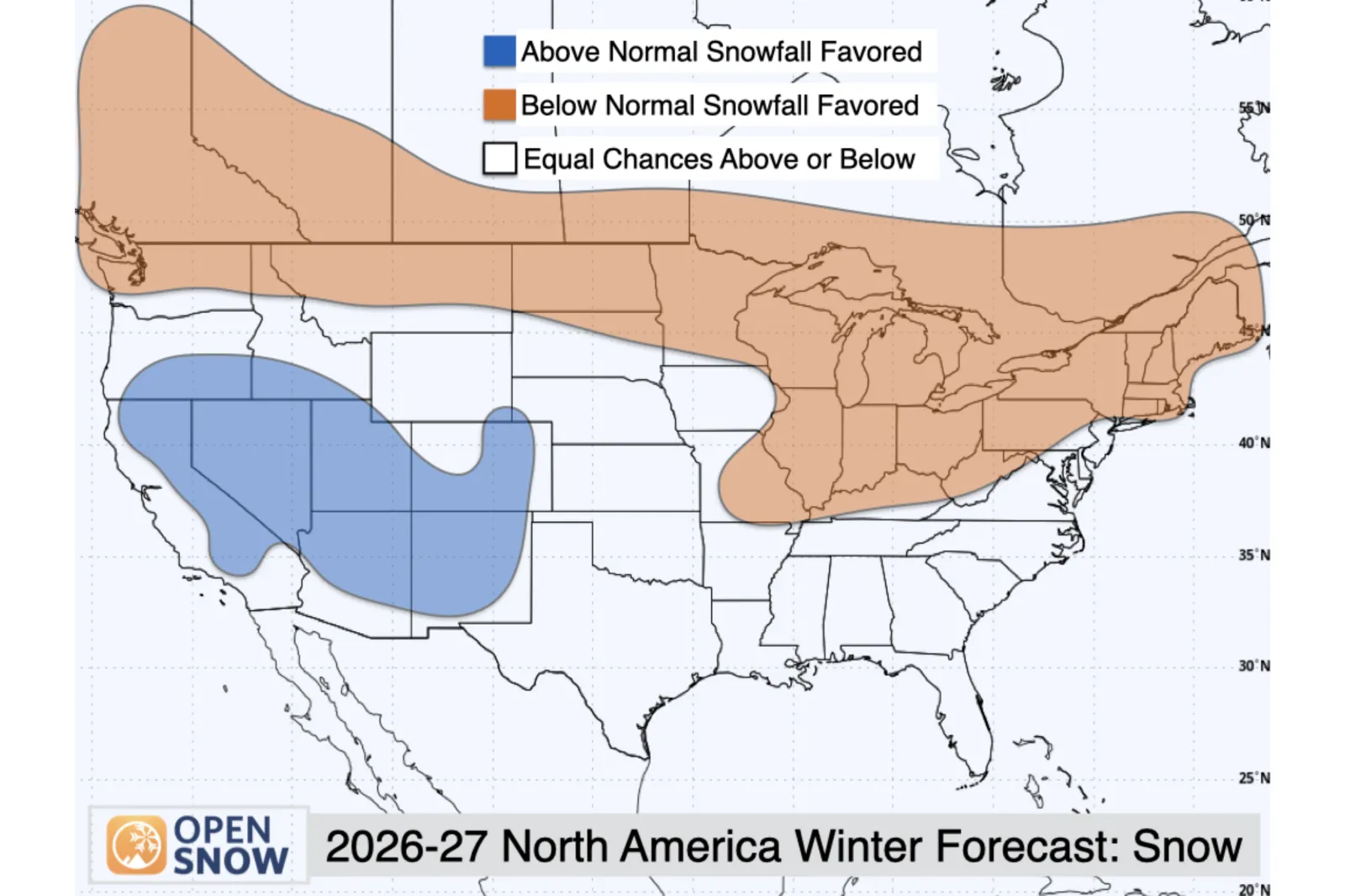
OpenSnow’s 2026-27 winter forecast favors above-normal snowfall across much of the Southwest, including California, Utah, Arizona, New Mexico, and parts of Colorado.
Forecasters say an active southern storm track, a classic hallmark of strong El Niño winters, could bring more frequent storm systems into those regions.
California, particularly the Central Sierra, is projected to have one of the strongest signals for above-average snowfall, while Utah ski areas and parts of southern Colorado are also favored for a snowier-than-normal season.
Meanwhile, the forecast indicates below-normal snowfall across parts of the northern U.S. and Canada, with Washington state among the regions where warmer-than-average temperatures may limit snowfall despite near-normal precipitation.
What It Means for Americans
For residents across the southern half of the country, a strong El Niño often increases the likelihood of a more active winter storm track, bringing wetter conditions and greater opportunities for mountain snowfall.
However, forecasters caution that warmer temperatures frequently accompany strong El Niño events. That means some storms could produce rain at lower elevations rather than snow, particularly in parts of the West.
The impacts are not uniform across the United States. NOAA notes that even the strongest El Niño events do not guarantee the same weather outcomes everywhere, though stronger events can tilt the odds toward typical El Niño patterns.
How El Niño Could Affect Ski Resorts and Weather Worldwide
For skiers, snowboarders and mountain communities, the forecast raises hopes for a rebound after a disappointing 2025-26 snow season in many western regions. OpenSnow says the most favorable period for snowfall in several key mountain areas may arrive between January and March, when the El Niño influence is expected to be strongest.
OpenSnow forecasts above-normal snowfall across much of the Alps, particularly from France into western Austria, as well as in Scandinavia. However, some lower-elevation Alpine resorts could still contend with warmer temperatures and periods of rain because temperatures are also forecast to run above average across parts of central Europe.
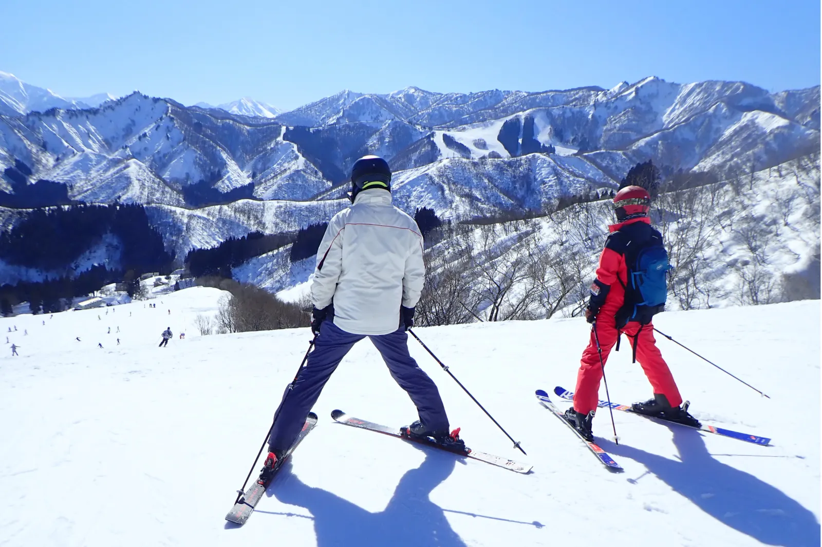
Japan, home to some of the world’s snowiest ski destinations, faces a different outlook. Forecasters project below-normal snowfall and above-normal temperatures across major ski regions, although snowfall totals could still be substantial by local standards, as average accumulations are typically very high.
With several months remaining before winter begins, forecasters emphasize that the seasonal outlook carries uncertainty. Still, the emergence of a potentially historic El Niño is already prompting meteorologists to watch closely as one of the most influential climate patterns on Earth continues to strengthen.
Newsweek has emailed NOAA for comment.