

Memorial Day travel map: Severe storms hit 7 states
Severe storms with large hail, damaging wind gusts, flooding downpours and a few tornados will complicate Memorial Day travel in parts of the Southern Plains, Mid-South and Tennessee Valley, a National Weather Service (NWS) forecast said.
Why It Matters
This year, the American Automobile Association (AAA) anticipated that more than 45 million people would travel at least 50 miles from home through Monday to celebrate Memorial Day. It was expected to set a Memorial Day weekend travel record.
Severe weather could disrupt plans for travelers on Monday as meteorologists are forecasting thunderstorms across Texas, Arkansas, Oklahoma, Louisiana, Kansas, Missouri and Tennessee.
What To Know
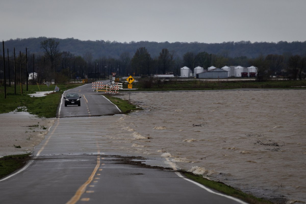
As of Monday morning, numerous storm-related weather alerts were in place, including flood watches, flood warnings, severe thunderstorm warnings and flash flood warnings.
“Multiple rounds of thunderstorms are forecast to impact portions of the Southern Plains, Mid-South, and Tennessee Valley through Memorial Day,” an NWS forecast said on Monday morning. “Severe thunderstorms may produce large hail, severe wind gusts, and a few tornadoes. Excessive rainfall is also likely and may result in scattered to numerous instances of flash flooding.”
Scott Olson/Getty
A tornado warning was issued earlier Monday morning in Shreveport, Louisiana.
Heavy downpours were posing dangers across multiple states, with AccuWeather meteorologists saying that some areas could receive more than a foot of rain once the holiday weekend comes to a close. Some of the worst flooding is occurring in the Ozark Mountains, and earlier this weekend, some roads were forced to close in Springfield, Missouri.
“Springfield received 2.68 inches of rain on Friday and Saturday. This ranks as the second highest rainfall amount for the two-day period of May 23-24,” AccuWeather Senior Meteorologist Chad Merrill said in the report.
An AccuWeather rainfall map showed the hardest-hit areas through Monday night will likely be southeastern Kansas, eastern Oklahoma, the northern half of Arkansas and Southern Missouri, as well as far Western Tennessee. Downpours will continue across the heavily affected areas through Monday, worsening the flooding, Merrill said.
Travel and outdoor plans in the worst-affected areas also are likely to be impacted. NWS guidance urges people not to drive on flooded roads, which could complicate travel plans.
What People Are Saying
NWS meteorologist Gary Chastelain, who works at the Shreveport, Louisiana, office, told Newsweek: “Most of the heavy rain we’ll see is occurring now. During the early afternoon we’ll get a nice break, and then another wave of activity will develop…tonight.”
AccuWeather Senior Meteorologist Chad Merrill, in a report: “Although northwestern Arkansas and northern Texas has not experienced the heaviest rain thus far, we expect pockets of heavy rain to expand across these areas through Monday.”
A flood watch issued by the Shreveport, Louisiana, NWS office: “Turn around, don’t drown when encountering flooded roads. Most flood deaths occur in vehicles. Be aware of your surroundings and do not drive on flooded roads.”
What Happens Next
Most flood watches will expire by Monday evening or Tuesday morning. The NWS said a slight risk of excessive rainfall is in place for parts of the Southern Plains, Lower Mississippi Valley, Southeast and Ohio Valley on Tuesday.